19/09/2018
Mobile “sentinels” to boost infrastructure safety
Nicoletta Ferrini
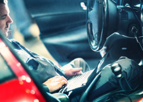
The relentless spread of smartphones might actually prove useful in boosting controls on the state of road infrastructures. Researchers from Boston’s MIT are convinced that a large number of data can be obtained from sensors embedded in mobile devices.
"Road safety" means more than just "vehicle safety". The collapse of the Morandi Bridge in Genoa last August 14th, has tragically brought the need – and the urgency - to improve ordinary and extraordinary maintenance programs to the fore, while increasing the level of preventive checks made on infrastructures at the same time. The game will inevitably be played at a political-institutional level. But there is more. Technology, in fact, could play a central role in providing a valuable contribution in making sure that increasingly safe vehicles travel on equally safe roads and bridges. Actually, the perfect solution might already be in our pockets thanks to our increasingly ubiquitous smartphones. This idea is supported by a research dated 2017 and carried out by a group of MIT researchers (Massachusetts Institute of Technology) in Boston, such as Thomas Matarazzo, Mohammad Vazifeh, Shamim Pakzad, Paolo Santi and Carlo Ratti, and published, last March, by the IEEE (Institute of electrical and electronic engineers): modern mobile phones can provide information about the real condition of the infrastructures we use every day. How? Simple, thanks to the technology found within them. Smartphones are in fact equipped with accelerometers (micro electro-mechanical systems), able to detect and measure any movement of the device on its three axes: height, length and depth. Therefore mobile phones can record data such as, for example, the vibrations of a bridge as we travel on it.
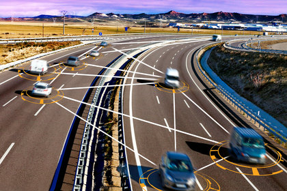
Many of the world's most famous bridges - from the Golden Gate in San Francisco (USA) to the Tower Bridge in Guangzhou (China) - are already equipped with tens or hundreds of embedded sensors capable of monitoring the number and intensity of even the slightest vibrations. The premise on which the MIT study is based is that every smartphone is equipped with dozens of sensors that can roughly do the same. Each mobile sensor, however, provides significantly better resolution data than a fixed one and, on its own, is therefore able to offer information comparable to those collected by over a hundred fixed sensors. This provides the perfect opportunity, according to the team of researchers, to exploit the exponential spread of smartphones to create a comprehensive network of "sentinels", thus multiplying the benefits of this type of analytical approach.
From words to actions: this hypothesis has already been tested by the same team of researchers using as a model the Harvard Bridge, a 600 metres long bridge that connects the cities of Boston and Cambridge, and is crossed every day by tens of thousands of vehicles of all kinds. The tests carried out compared the data collected from a dozen fixed accelerometers with those generated by a pair of iPhones on two separate cars. To make the conditions as realistic as possible, both vehicles crossed the bridge 42 times at moderate speed during peak traffic hours, i.e. when the quantity and intensity of the vibrations produced was greater. The results, albeit not conclusive, were considered decidedly encouraging: the data collected by the two smartphones are, in fact, comparable to those produced by fixed sensors.
Hunting for “holes”
Other ideas and projects, besides the one being carried out by the prestigious US institute, are now under scrutiny, aimed at creating advanced solutions able to provide a thorough and timely "vision" of the real conditions of our infrastructures. A few years earlier, in fact, the Boston municipality had launched BumpStreet, an application used to detect potholes when driving over one. As was the case with the most recent MIT study, here too the idea was to capitalize on the spread of smartphones among citizens to collect useful data on urban road conditions, monitor the state of the road surface and consequently reduce the number of accidents not to mention costs of maintenance. Leaving Boston and drawing closer to our reality, several similar initiatives have likewise sprung up. The Department of Civil Engineering of the University of Calabria has developed a monitoring system dedicated to the quality of road surfaces and detecting critical issues, using smartphones and carried out an "ad hoc" experiment, using an application called TutorDrive. The latter, in addition to being a real driving assistant, uses a combined smartphone/web-server system capable of detecting and managing any critical issue related to the state of the road surface.
Another app, named RoadChecker, is based on the same logic. Made by an Italian developing firm, Cleis Tech, this app - currently available only for Android operating systems - is designed to collect data on the current conditions of the roads so as to avoid driving, unless necessary, over the most damaged stretches. Similarly to the above mentioned cases, RoadChecker too uses sensors integrated in smartphones (accelerometer, gps, gravity sensor, gyroscope etc.) to detect holes and bumps. The declared objective is to create a community that, with its movements, contributes to building a detailed and constantly updated map of the road network.
Finally, among the latest efforts, we find Moto.app, a free of charge application, strongly supported by Confindustria and Ancma, the National cycle, motorcycle and accessories association, which allows users not only to record their movements and obtain information on their riding style, but also to map potholes. In addition to being an important safety tool for each individual “biker”, it is believed that the collected data could contribute to increasing the general level of road safety.